


8 Day African Safari & River Trip
$6995
per person based on double occupancy
2026 Dates:
September 26 – 3
October 2 – 9
Deposit: $1000 Single Supplement: $2000 Meeting Place: Victoria Falls, Zimbabwe or Livingstone, Zambia Gateway City: Johannesburg, South Africa River Rating: Class V Age Range: 13 – 80
Itinerary | Accommodations | About the Region
Explore the Zambezi River Basin and the game parks of Zimbabwe and revel in one spectacular African adventure after another. This incredible journey starts in Victoria Falls with a two-night stay at The Wallow Lodge overlooking the Zambezi River giving us ample time to explore Victoria Falls. We then hike down to the frothing foot of Victoria Falls where we board the rafts for 3 incredible days and 2 nights of rafting the Class V whitewater of the Zambezi River in Batoka Gorge. We’ll camp riverside and relax on the sandy beaches and in the cool pools of this mighty river. From there, we return for one night at Waterfalls Lodge before you are quickly whisked to Iganyana Tented Camp in Hwange National Park for two glorious nights and go on game drives and walking safaris. September through November are the best months to see game and experience the Zambezi Basin as it’s the end of the dry season and all of the animals come down to the banks of the river to drink, swim and frolic in the shallows. The bush has been either eaten or has died down, so seeing the animals is much easier.
Our unique trip combines five star decadence with fun-filled days of adventure while exploring a wide variety of environments in search of the Big Five. We will visit one of Zimbabwe’s most revered national parks as well as explore remote wilderness areas rarely visited. The wildlife in the Zambezi Basin has thrived and the elephant herds of Zimbabwe are among the largest and most protected of Africa. The game viewing is outstanding and our trip allows you to experience Africa without the crowds. We use 5 star lodges combined with wilderness outpost camps so you get to immerse yourself in true African style. This trip dovetails with or our Cape Town Multi-Sport.
Itinerary at a Glance
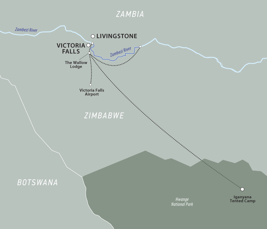
- Arrive Victoria Falls and transfer to The Wallow Lodge overlooking the river
- Enjoy two nights a the Wallow, with game drives and a tour of Victoria Falls rainforest
- Explore the Zambezi and Batoka Gorge on a 3 day/2 night river expedition
- Camp on sandy beaches and soak in cool pools
- Challenge the mighty Zambezi’s huge, but user-friendly rapids
- Return to Victoria Falls to relax in your luxurious hotel
- Transfer to Iganyana Tented Camp and its private concession on the border of Hwange National Park
- Search for the Big 5 on game drives and walking safaris
What to Expect on the ROAM Zambezi River Express
Day 1
Arrive at Victoria Falls Airport, Zimbabwe (or Livingstone, Zambia). Soon after you land we will transfer to The Wallow Lodge and rendezvous with our trip leader for a welcome briefing. We’ll enjoy a toast after flying halfway around the world to converge on the incredible Victoria Falls and Zambezi River. We’ll settle into our suites on the banks of the Masuwe River with uninterrupted views of the wildlife from the private balconies. Overnight The Wallow Lodge.
Day 2
We’ll start our first full day in Africa with a delicious breakfast at The Wallow Lodge. Then it’s off to explore the Victoria Falls rainforest for an interpretive tour. There will also be opportunities for game drives and if we have time, we’ll stop at charming shops and markets in the town of Victoria Falls. Finally, we’ll meet for cocktails overlooking the dramatic Batoka Gorge – our home for the next three days!
Days 3, 4, 5
Time to raft the big river! Today we begin our journey into the gorge below Victoria Falls. First we hike down a steep trail to meet our waiting rafts. After a safety briefing we launch downstream and begin our river journey toward the Indian Ocean. With both paddle and oar boats, our days are spent navigating some the world’s biggest and most dynamic rapids. The river gorge starts out deep and steep, twisting and bending to form a series of sinuous goosenecks. The canyon rim looms overhead as we come face to face what some call “Nyami-Nyami”, the Zambezi river god, more easily recognized as the heart pounding and enormous rapids (about one per mile). On our first day we will challenge 21 rapids before reaching and expansive riverside camp.
The air is hot and dry, the water a mild 70 degrees, and the breeze that sweeps up the canyon is fragrant with the wilds of Africa. Our first night’s camp is where we meet our gear as porters carry it into the gorge for us. This camp is complete with tents, dining area and a spacious beach. The gear boat guides will meet us here as we bring everything downriver with us from this point.
Once we are “self supported” we’ll raft deeper into the Batoka gorge, running Wake up Call, Open and Closed Season and camping on big sandy beaches. As we travel downstream, the rapids spread out and we enter some big open valleys. We also come upon two waterfalls. The first, upper Moemba we will run and the second is an easy portage as we lower the rafts over a 30-foot vertical cliff into an eddy-pool below. We make camp right below this portage and the following morning walk out of the gorge to waiting vehicles to take us to Waterfalls Lodge and a tour of the falls.
Days 6 & 7
After breakfast, we’ll transfer transfer to Iganyana Tented Camp on a private concession that borders Hwange National Park. While at Iganyana, guests can choose game drives and walks, or simply lounge by the pool and get your fill of the wonderful game viewing that is available here. Your professional guides will show you some of the large and small wildlife of Iganyana’s private concession. The chance to get up close and personal with these amazing species is very exciting and who can ever forget their first elephant or leopard encounter! Overnight Iganyana tented camp both nights.
Day 8
Today we’ll say goodbye to Hwange National park, Victoria Falls and the mighty Zambezi and as we transfer to the airport for flights home or onward, we’ll reflect on this unique and adventurous part of the world and the remarkable people we’ve met along the way.
Safari Accommodations
The Wallow Lodge
The Wallow Lodge is situated in a private game reserve, peacefully nestled in the heart of the Victoria Falls National Park. The tented camp is set along the banks of the Masuwe River, surrounded by 4,500 acres of wilderness that stretches into the horizon, where a cloud of mist from the ‘Mosi-Au-Tunya’ commands the skyline.
Victoria Falls is a short twenty-minute transfer from the lodge, giving guests the freedom to tailor-make their experience and find a balance between the exclusivity of the bush and the excitement of Africa’s Adventure Capital.
Waterfalls Lodge


Set in the heart of Victoria Falls, Zimbabwe, Waterfalls Lodge offers convenience, comfort, and adventure. Located just minutes from the iconic Victoria Falls and vibrant town centre, this stylish lodge puts you right in the middle of the action, while providing a peaceful retreat when you are ready to unwind.
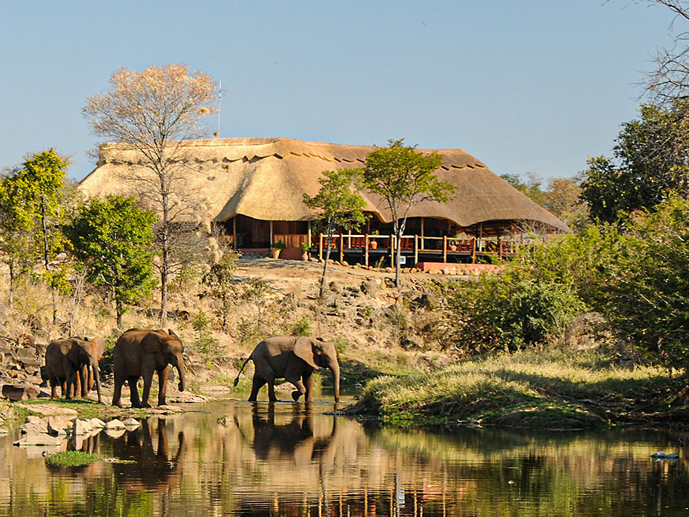
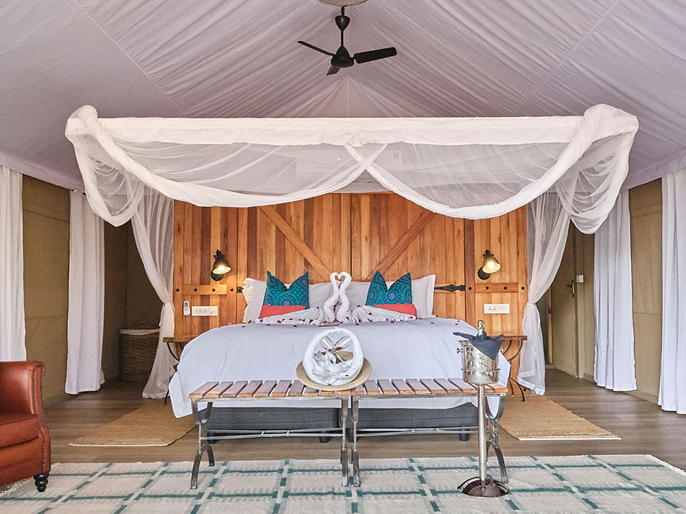
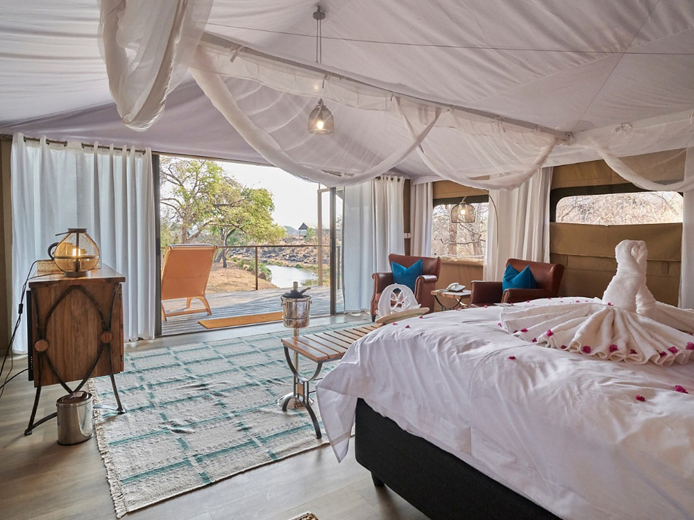
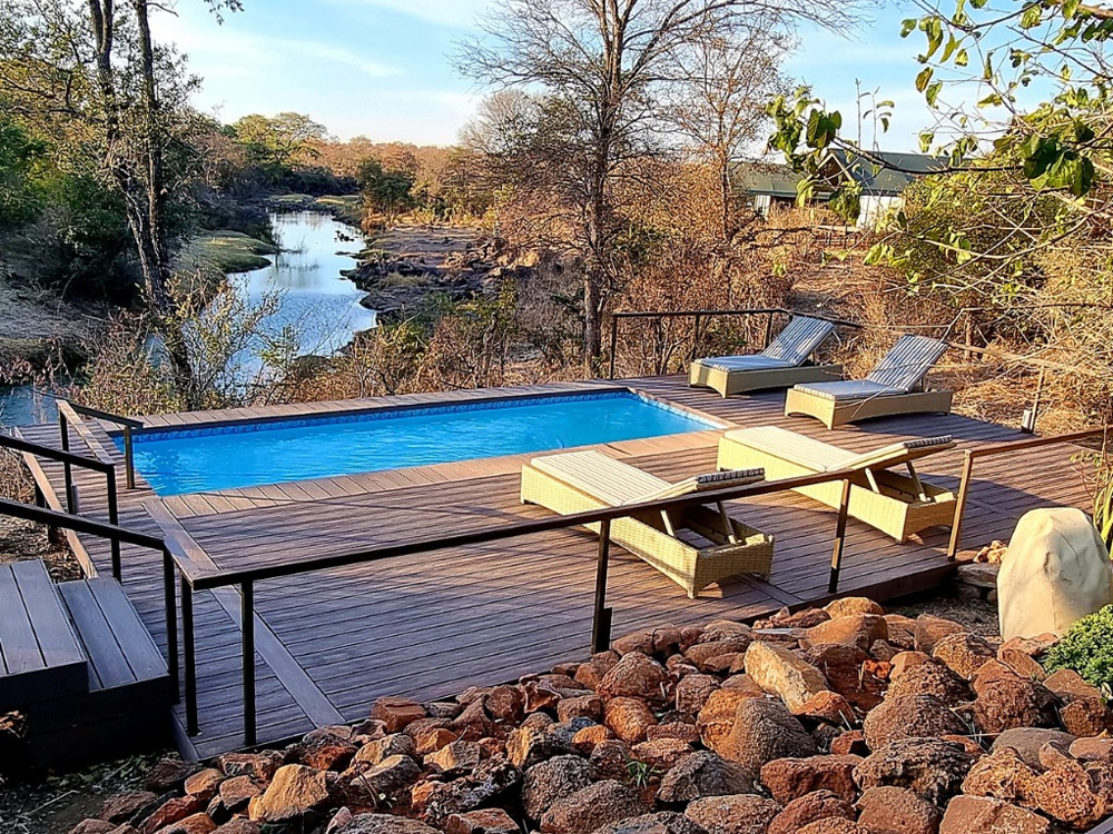
Iganyana Tented Camp
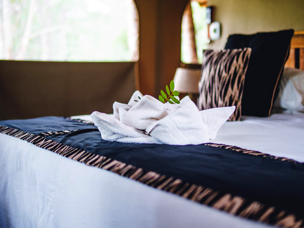
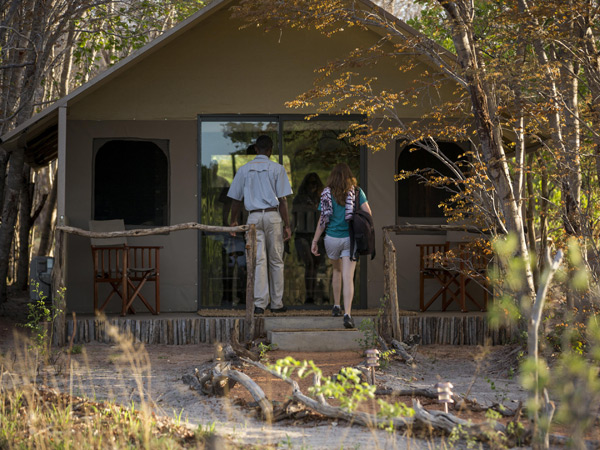
Tucked into a teak forest, Iganyana Tented Camp looks out over the wide, open grass plain of a long-dry riverbed. This is, in fact, a highway of sorts. However, the only traffic on it is wildlife on their daily commute between waterholes – one of which is directly in front of the camp. Natural walkways of compacted red river sand leads to the center of the camp. Here, tall rain trees shade the large Bedouin tented dining and living area. This opens onto a large, raised wooden deck with a swimming pool, overlooking the waterhole just a stone’s throw away. Below the deck is the boma with a fire pit: the hearth and heart of the luxury camp. A low, sculptural wall of twisted acacia boughs is all that separates you from the wilderness beyond.
About the Zambezi River and Victoria Falls Region
The Zambezi River
Zambezi River, also spelled Zambesi, is a massive river system draining a large portion of south-central Africa. Together with its tributaries, it forms the fourth largest river basin of the continent. The river flows eastward for about 2,200 miles (3,540 kilometres) from its source on the Central African Plateau to empty into the Indian Ocean. With its tributaries, it drains an area of more than 500,000 square miles (1,300,000 square kilometres). The Zambezi (meaning “Great River” in the language of the Tonga people) includes along its course the Victoria Falls, one of the world’s greatest natural wonders, and the Kariba and Cahora Bassa dams, two of Africa’s largest hydroelectric projects. The river either crosses or forms the boundaries of six countries—Angola, Zambia, Namibia, Botswana, Zimbabwe, and Mozambique—and the use of its waters has been the subject of a series of international agreements.
Physiography
The Zambezi rises out of a marshy bog near Kalene Hill, Zambia, about 4,800 feet (1,460 metres) above sea level, and flows some 20 miles before entering Angola, through which it runs for more than 175 miles. In this first section of its course, the river is met by more than a dozen tributaries of varying sizes. Shortly after reentering Zambia, the river flows over the Chavuma Falls and enters a broad region of hummocky, sand-covered floodplains, the largest of which is the Barotse, or Zambezi, Plain. The region is inundated during the summer floods, when it receives fertile alluvial soils. The main tributaries intersecting the river along the plains are the Kabompo River from the east and the larger Lungué-Bungo (Lungwebungo) River from the west.The Zambezi then enters a stretch of rapids that extends from Ngonye (Sioma) Falls south to the Katima Mulilo Rapids, after which for about 80 miles it forms the border between Zambia to the north and the eastern Caprivi Strip—an extension of Namibia—to the south. In this stretch the river meanders through the broad grasslands of the Sesheke Plain until it is joined by the Cuando (Kwando) River. Near Kazungula, Zambia, the river, after flowing past Botswana territory to the south, turns almost due east and forms the frontier between Zambia and Zimbabwe. From the Cuando confluence to the Victoria Falls, the Zambezi varies considerably in width, from open reaches with sand islands to stretches of rapids through narrow channels separated by numerous rock islands.
Victoria Falls mark the end of the upper course of the Zambezi, as its waters tumble with a thunderous roar and an enormous cloud of spray. The area around the falls was once covered by a thick layer of lava, which as it cooled formed wide cracks, or joints, that became filled with softer sediments. As the Zambezi cut its present valley it encountered one of these joints, eroded the sediment, and created a trench, eventually forcing a gap at the lower end of the trench that quickly widened into a gorge. The force of the water also created a second gap at the upper end of the trench that gradually diverted the river until the trench itself was left dry. As the river cut backward it repeated the process, scouring eight successive waterfalls in the past half million years.
The Zambezi’s middle course extends about 600 miles from Victoria Falls to the eastern end of Lake Cahora Bassa in Mozambique. It continues to form the boundary between Zambia and Zimbabwe until it crosses the Mozambique border at Luangwa. Below the falls a gorge some 60 miles long has been formed by the trench-scouring process, through which the river descends in a series of rapids. Just upstream of Lake Kariba the river valley widens and is contained by escarpments nearly 2,000 feet high. The middle Zambezi is notable for the two man-made lakes, Kariba and Cahora Bassa (see below), that constitute much of this stretch of the river. Between the two lakes the Zambezi trends northeast for nearly 40 miles before it turns east below the confluence with the Kafue River, the Zambezi’s largest tributary. In this section the river rushes through two rocky, narrow gorges, the first just below the Kariba Dam and the other above the confluence with the Luangwa River.
At the dam at the eastern end of Lake Cahora Bassa, the Zambezi begins its lower course, during which it descends from the Central African Plateau to the coastal plain. At first the hilly country is replaced by flat areas at the head of the Tete Basin, and the river becomes more placid. About 40 miles downstream the river has cut the Lupata Gorge through a range of hills, where it emerges onto the Mozambique Plain and occupies a broad valley that spreads out in places to a width of three to five miles. Near Vila Fontes the river receives its last great tributary, the Shire River, which drains Lake Nyasa (Malaŵi) some 210 miles to the north.
At its mouth the Zambezi splits into a wide, flat, and marshy delta obstructed by sandbars. There are two main channels, each again divided into two. The wider, eastern channel splits into the Muselo River to the north and the main mouth of the Zambezi to the south. The western channel forms both the Inhamissengo River and the smaller Melambe River. North of the main delta the Chinde River separates from the Zambezi’s main stream to form a navigable channel leading to a shallow harbour.
Hydrology
The Zambezi, according to measurements taken at Maramba (formerly Livingstone), Zambia, experiences its maximum flow in March or April. In October or November the discharge diminishes to less than 10 percent of the maximum. The annual average flow reaches about 247,000 cubic feet (7,000 cubic metres) per second. Measurements taken at Kariba Dam reflect the same seasonal pattern; the highest flood recorded there was in March 1958, when the flow reached 565,000 cubic feet per second.
Climate of the Zambezi River
The Zambezi River lies within the tropics. The upper and middle course of the river is on an upland plateau, and temperatures, modified by altitude, are relatively mild, generally between 64° and 86° F (18° and 30° C). The winter months (May to July) are cool and dry, with temperatures averaging 68° F (20° C). Between August and October there is a considerable rise in average temperatures, particularly in the river valley itself; just before the rains begin in October temperatures there become excessively hot, often reaching 104° F (40° C). The rainy season lasts from late November to April. Rain falls in short, intense thundershowers—the rate sometimes reaching 6 inches (150 millimetres) per hour—with skies clearing between downpours. In these months the upper Zambezi receives nearly all its total rainfall, and this accounts for the great variation in the flow of the river throughout the year. In all, the upper and middle Zambezi valley receives 22 to 30 inches of rain per year. Studies have suggested that a microclimate in the area of Lake Kariba has created a rise in precipitation, possibly as a result of a lake breeze blocked by the escarpment that produces thunderstorms. In the lower course of the river in Mozambique the influence of the summer monsoon increases the levels of precipitation and humidity. Temperatures are also higher—determined more by the latitude and less by altitude—as the river descends from the plateau.
Plant life
The vegetation along the upper and middle course of the Zambezi is predominantly savanna, with deciduous trees, grass, and open woodland. Mopane woodland (Colophospermum mopane) is predominant on the alluvial flats of the low-lying river valleys and is highly susceptible to fire. Grass, when present, is typically short and sparse. Forestland with species of the genus Baikiaea, found extensively on sandy interfluves between drainage channels, is economically the most important vegetation type in Zambia, for it is the source of the valuable Rhodesian teak (Baikiaea plurijuga). Destruction of the Baikiaea forest results in a regression from forest to grassland, a slow process involving intermediate stages of scrub vegetation. The river additionally has a distinct fringing vegetation, mainly riverine forest including ebony (Diospyros mespiliformis) and small shrubs and ferns (e.g., Haemanthus). In the lower course of the Zambezi, dense bush and evergreen forest, with palm trees and patches of mangrove swamp, is the typical vegetation.
Animal life
The tiger fish is one of the few species found both above and below the Victoria Falls. Pike is predominant in the upper course of the river, as are yellowfish and barbel. Bream are now common both above and below the falls. Crocodiles abound in the Zambezi, though they generally avoid stretches of fast-running water. Hippopotamuses are also found in the upper and lower stretches of the Zambezi.
Elephants are common over much of the river’s course, particularly in areas such as the Sesheke Plain and near the Luangwa confluence. Game animals include buffalo, eland, sable, roan, kudu, waterbuck, impala, duiker, bushbuck, reedbuck, bushpig, and warthog. Of the big cats, lions can be found in the Victoria Falls National Park in Zimbabwe and elsewhere along the river’s course; cheetahs, although comparatively rare, can be sighted; and leopards, rarely seen by daylight, are common, both in the plains and the river gorges. Baboons and monkeys abound throughout the region.
The People
The Lozi (Barotse), who dominate much of the upper Zambezi, have taken advantage of the seasonal flooding of the Barotse Plain for centuries and have an agricultural economy that is supplemented by animal husbandry, fishing, and trade. The main groups of the middle Zambezi include the Tonga, Shona, Chewa, and Nsenga peoples, all of whom largely practice subsistence agriculture. In Mozambique the riverine population is varied; many engage in commercial agriculture—the growing of sugarcane and cotton in particular—which was established by the Portuguese.